
Ewing Township ZIP Code Directory Coverage
The Ewing welcome material identifies four ZIP codes serving the township: 08560, 08618, 08628, and 08638. They are postal geographies shared with nearby Trenton and Titusville, not four township districts. The labels in the table are the useful starting point for a mailing-address check. They should not be treated as a street-by-street boundary map, ownership list, or roster of people.
| ZIP | Areas Covered | Post Office | Notes |
|---|---|---|---|
| 08560 | Ewing-area addresses using the Titusville route and Titusville | Titusville postal route; Ewing or Titusville accepted in the town guide | Shared postal geography; verify each street because the guide has an OCR or alias inconsistency |
| 08618 | Ewing and adjacent Trenton or TCNJ-area addresses | Ewing or Trenton postal label | The TCNJ Administration Services election drop-box address uses this ZIP |
| 08628 | Ewing, West Trenton, and Trenton addresses | West Trenton postal route; Ewing, West Trenton, or Trenton labels may appear | Ewing Municipal Building at 2 Jake Garzio Drive uses this ZIP |
| 08638 | Ewing and Trenton addresses, including the Mercer County Office Park area | Ewing or Trenton postal label | The Mercer County Office Park election drop-box address uses this ZIP |
For the exact delivery answer, check the full street with USPS. Postal labels serve mail routing. Mercer County property and recorded-land research instead depends on the municipality and a parcel or legal-description key. Keeping both forms of geography avoids a common error: interpreting an Ewing mailing label as proof that an address is inside every Ewing Township boundary.
Ewing Township ZIP Code Labels
Postal aliases explain why a ZIP code directory needs more than a list of numbers. The town guide says 08560 accepts Ewing or Titusville, 08618 accepts Ewing or Trenton, 08628 accepts Ewing, West Trenton, or Trenton, and 08638 accepts Ewing or Trenton. The 08560 text also contains an 08650 line that conflicts with the guide’s own ZIP heading and list. That is a known source quirk, not a reason to guess the correct code for a street.
08628 is the strongest local example of the label issue. The Ewing Municipal Building uses that ZIP, while West Trenton and Trenton can also appear as postal city names. The official Titusville USPS location page provides the nearby Titusville Post Office information for the 08560 route.
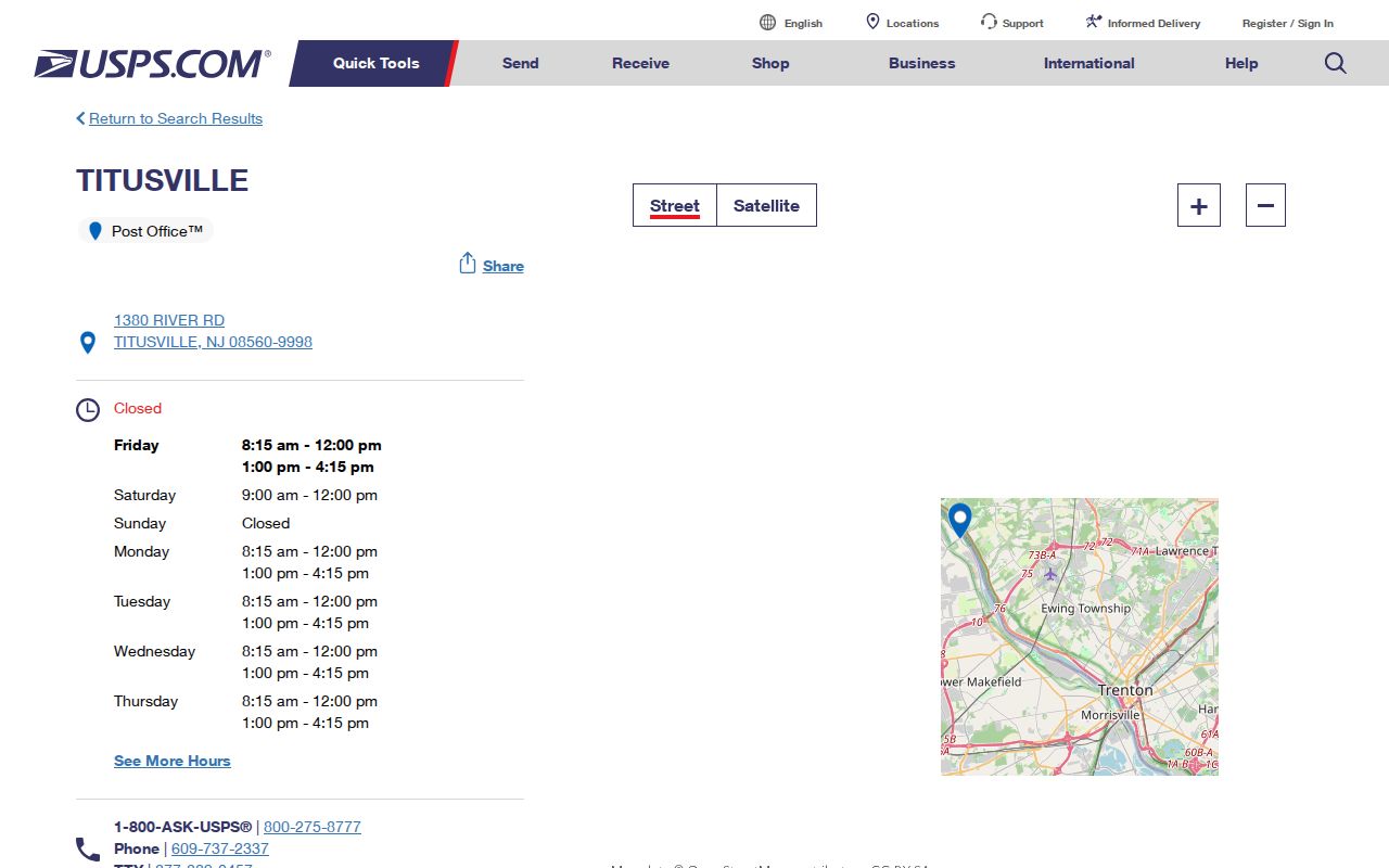
The post-office image supports a delivery-route check for the Ewing Township ZIP code directory. It does not establish a township line or determine which municipal record custodian holds a property file.
Note: When a directory, deed, or old letter has a conflicting city label, preserve the printed label and verify the present street address through USPS before using it for a current mailing record.
Verify an Ewing Township ZIP Code
USPS ZIP Lookup is the delivery check for a complete address. Enter the street address, city, and state, then use the returned ZIP and postal city label as the current mail-routing result. A city label from USPS can differ from the legal municipality. Record both values when a result will be compared with an Ewing assessment, county deed, permit, or civic address.
| USPS field or result | How it is used |
|---|---|
| Street address | Supplies the physical delivery location for the ZIP lookup. |
| City | Provides the postal locality supplied with the street address. |
| State | Limits the address search to New Jersey for an Ewing-area check. |
| Returned ZIP and city label | Confirms the delivery route and postal label for the entered address. |
The returned ZIP is a delivery result, not a resident lookup result. A changed postal label, an apartment omission, a wrong street direction, or a similar street name can alter a mailing match. Save the source date if a record needs to be rechecked later. Keep the USPS city line separate from the Ewing Township municipality in a research log. That distinction helps when a Clerk town selection, deed legal description, and mailing envelope use different place labels.
Ewing Township ZIP Code Record Steps
A ZIP can help organize an address question, but the local portals do not offer a confirmed ZIP-wide person or parcel search. NJGIN Property Explorer uses address, county, municipality, block, and lot. Mercer Clerk records use town, lot and block, party, instrument, book and page, or legal description. Ewing SDL publishes address, owner, and block-and-lot modes behind an account. Use the ZIP as a verified display detail, then move to the key accepted by the actual custodian.
- Run the complete street address through USPS and write down the returned postal city label and ZIP.
- Search NJGIN Property Explorer with the address, county, and municipality to locate parcel geometry and any available block-and-lot context.
- Use the municipality and block or lot in the Mercer County Official Records Search when the question concerns a deed, map, mortgage, lien, or legal description.
- Keep the ZIP as a postal field beside the Ewing Township municipality, source, and date. Do not claim that one ZIP query returns all residents or all properties in that delivery area.
Once a verified ZIP narrows an address to a street, the Ewing Township street directory provides the separate address-keyed workflow. Its parcel and deed sequence should not be replaced by a ZIP-only shortcut.
Ewing Township ZIP Code Portal Keys
The public Ewing Township Assessor page links to a property-assessment lookup, but the embedded live fields were not exposed in the research. That means an owner-name search cannot be promised from the public page. NJGIN is a statewide map with parcel and address context, but hosted owner names are redacted under Daniel’s Law. The former Mercer Property Information Portal is closed to anonymous and registered public access for the same privacy setting.
For land records, the Clerk’s index is the more specific route. Its available search modes include party, instrument number, book and page, town and lot or block, document type, and legal description. Its online McPress material begins approximately in 1997; older work belongs in the Records Room and deed books. A ZIP code is not a substitute for the property’s legal description or parcel identifier.
Note: No confirmed ZIP-specific filter was found for Ewing SDL, NJGIN, the Mercer Clerk index, or the public assessor page, so a bulk ZIP people search should not be represented as available.
Ewing Township ZIP Code Address Roles
Several address terms appear in Ewing Township records, and they do different work. The situs address is the physical property location used in assessor, GIS, permit, and citation work. A mailing address is the destination for tax or owner correspondence and may be outside Ewing. A legal description uses municipality, block, lot, subdivision, map, metes and bounds, or deed language. It may not contain a modern street address at all.
- ZIP versus ZIP+4
- A ZIP identifies a postal delivery area. ZIP+4 adds a more precise delivery segment within that routing system.
- PO-box ZIP
- A ZIP assigned for post-office boxes rather than a claim that every street address in an area uses it. No Ewing-specific PO-box ZIP was confirmed in the research.
- Unique ZIP
- A code associated with a single large organization or destination. None was confirmed for Ewing Township in the research.
- Carrier route
- A postal delivery sequence used to organize mail. It is not a township boundary, parcel boundary, or resident list.
A ZIP match is therefore not an ownership or residency match. Compare the street address, legal municipality, and parcel information before connecting a postal result to an Ewing Township record.
Ewing Township ZIP Code Geography
Postal geography sits over a longer local jurisdiction history. Ewing formed in 1834 and shifted from Hunterdon County to Mercer County when Mercer formed in 1838. Older material may use Trenton Township, Hunterdon County, Mercer County, Ewingville, West Trenton, or a regional Trenton directory title. Those names are useful search bridges when a historic address has no modern ZIP line.
The township is bounded by the Delaware River, Trenton, Hopewell, and Lawrence. Its welcome material describes about 15.6 square miles, but no official street-by-street ZIP boundary map or complete Ewing street list by ZIP was located. A polygon or postal approximation should not replace a USPS street check. For a historic record, retain the name printed at the time and compare the address with county, municipality, map, and deed context.
Ewing Township ZIP Code Boundaries
Ewing Township city limits and ZIP code boundaries serve different purposes. A Titusville, West Trenton, or Trenton postal label can be correct for an Ewing address, while the same ZIP can reach beyond the township. The 08618, 08628, and 08638 election drop-box examples show that Ewing civic locations sit within more than one postal geography. County and municipal custodians still need their own legal location keys.
Use the municipality first for Mercer Clerk and GIS work, then preserve the USPS label for mail. No official Ewing ZIP-wide resident output, complete ZIP street map, or separate Ewing reverse-directory title was found. That absence is important: a postal code is a useful address-verification layer, not a way to infer a household list from geography.